As a general rule, KP Index shouldn't be above 4 or 5, due to possible disruptions and unreliable satellite signals.
INDOT's GNSS Reference System delivers:
|  |
Providing a real-time kinematic (RTK) correction service over the internet, and RINEX files for post-processing .You don’t have to be a Leica user to enjoy the benefits of INDOT's GNSS. If your GPS or GNSS receiver can connect to the internet, INDOT can deliver the data you need.
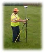
With this service offered by INDOT using Leica's GNSS Technologies you don't need to invest in an extra base station to get accurate positions. You don't need to setup a base station first and worry about its safety. Just start your GNSS rover and connect. A few seconds later, you have the ability to survey with cm-accuracy.
Important: Updated Broadcast Corrections(pdf)
Trimble Support Notice to InCORS Users:
| IMPORTANT NOTIFICATION |